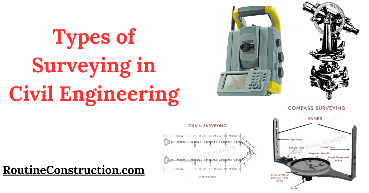
Surveying is an essential process in civil engineering, helping engineers gather necessary data about the land.
This article will explore the types of surveying in civil engineering, discussing their functions and importance.

What is Surveying in Civil Engineering?
Surveying involves measuring and mapping the environment using specialized tools. This data helps civil engineers plan and design construction projects. Understanding the different types of surveying in civil engineering is important for successful project execution.
Types of Surveying in Civil Engineering
Based on the Surveying Instruments
| Type of Surveying | Description |
|---|---|
| Chain Surveying | Uses a chain or tape to measure distances between points. |
| Compass Surveying | Measures angles between points using a compass. |
| Theodolite Surveying | Measures both horizontal and vertical angles with a theodolite. |
| Plane Table Surveying | Involves drawing a map directly onto a table in the field. |
| Tacheometric Surveying | Measures distances indirectly using a tacheometer. |
| Aerial Photographic Surveying | Takes photos from the air using drones or aircraft for large area coverage. |
| Remote Sensing | Gathers data about the earth’s surface using satellites or aircraft. |
| GPS Surveying | Determines precise locations using the Global Positioning System. |
| Laser Scanning Surveying | Creates detailed 3D models using lasers. |
| Total Station Surveying | Combines theodolite and electronic distance measurement functions. |
| Drone Surveying | Uses unmanned aerial vehicles to capture data from hard-to-reach areas. |
1: Chain Surveying
Chain surveying is one of the oldest and simplest types of surveying in civil engineering. It uses a chain or tape to measure distances between points on the ground. This method is best for small, flat areas with few hindrances.

Tools Used
Chain or Tape: For measuring distances.
Arrows: To mark points.
Ranging Rods: For alignment.
2: Compass Surveying
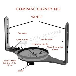
Compass surveying uses a compass to measure angles between points. It’s useful in areas with many hindrances where chain surveying isn’t practical.

Tools Used
Compass: For measuring angles.
Chain or Tape: For distance measurement.
3: Theodolite Surveying
Theodolite surveying is a more advanced method that measures both horizontal and vertical angles. It’s one of the most precise types of surveying in civil engineering used for large projects.

Tools Used
Theodolite: For measuring angles.
Tripod: To support the theodolite.
4: Plane Table Surveying
Plane table surveying involves drawing a map directly onto a table set up in the field. This method is quick and provides a visual representation of the area.
Tools Used
Plane Table: For drawing maps.
Alidade: For sighting and drawing lines.
5: Tacheometric Surveying
Tacheometric surveying is used to measure distances indirectly. It involves using a tacheometer, which is a special type of theodolite.
Tools Used
Tacheometer: For measuring distances and angles.
Staff: For target sighting.
6: Aerial Photographic Surveying
Aerial photographic surveying involves taking photos from the air, usually with drones or aircraft. This method covers large areas quickly and provides detailed images.
Tools Used
Cameras: Mounted on drones or aircraft.
GPS: For location tracking.
7: Remote Sensing
Remote sensing uses satellites or aircraft to gather data about the earth’s surface. It’s one of the most advanced types of surveying in civil engineering providing detailed and extensive data.
Tools Used
Satellites: For capturing images.
Sensors: For data collection.
8: GPS Surveying
GPS surveying uses the Global Positioning System to determine precise locations. It’s widely used due to its accuracy and convenience.
Tools Used
GPS Receivers: For location data.
9: Laser Scanning Surveying
Laser scanning surveying uses lasers to create detailed 3D models of an area. It’s highly accurate and useful for complex structures.
Tools Used
Laser Scanners: For capturing 3D data.
10: Total Station Surveying
Total station surveying combines the functions of theodolites and electronic distance measurement. It’s one of the most versatile types of surveying in civil engineering

Tools Used
Total Station: For measuring angles and distances electronically.
11: Drone Surveying
Drone surveying uses unmanned aerial vehicles to capture data. It’s efficient and can access hard-to-reach areas.
Tools Used
Drones: Equipped with cameras and sensors.
Importance of Different Types of Surveying in Civil Engineering
Each type of surveying plays an important role in civil engineering projects. Accurate measurements and data are essential for planning, design, and construction. Understanding the various types of surveying in civil engineering helps engineers choose the best method for their specific project needs.
Conclusion
In conclusion, Surveying is a core element of civil engineering. By understanding the different types of surveying in civil engineering professionals can ensure precise and efficient project execution. Whether using traditional methods like chain surveying or advanced techniques like laser scanning, each type has its unique benefits and applications.
This article has covered the various types of surveying in civil engineering explaining their functions and importance. By using these methods, civil engineers can gather the essential data needed for successful project planning and execution.
